
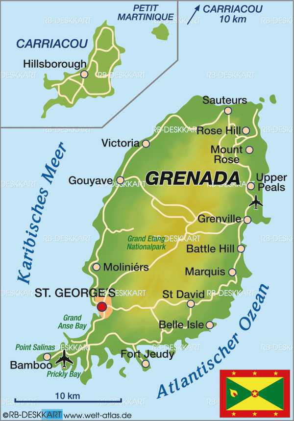
Mapping Grenada
|
Objective: Use map skills to plot key locations on Grenada and identify them using symbolic representations.
Read the descriptions of the following locations and plot the points indicated on the map to the right. Label each point with a colored symbol according to the key below. Using the map on page 3 in your Top Secret Agent File plot the mapping coordinates.
|


TOP Secret Agent File - Mapping coordinates
A-18 through B-18: Point Salines Airport is the largest airport in Grenada.
D-14: Fort Rupert is one of the forts built on Grenada.
E-14: Government House on Grenada is where the governor of Grenada lives.
C-18: Two campuses make up St. George's University Medical School on Grenada. The largest campus is located at True Blue.
D-16: Grand Anse is the oldest campus of St. George's Medical School.
D-15: St. George's is the capital of Grenada.
M-6: Pearls Airport is located at the north end of the island.
F-15: Fort Frederick is a fort that was constructed by the French.
I-6: Mount St. Catherine is the highest elevation in Grenada.
K-7: Mount Horne is the second highest elevation in Grenada.
